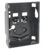
Difference between revisions of "GPSMAP 695"
(→Features) |
(→Features) |
||
| Line 90: | Line 90: | ||
==Features== | ==Features== | ||
*Large 7" diagonal WVGA TFT sunlight readable display | *Large 7" diagonal WVGA TFT sunlight readable display | ||
| − | *5 Hz | + | *5 Hz high-sensitivity GPS receiver |
*Flight Plans: 50 routes with up to 300 points each | *Flight Plans: 50 routes with up to 300 points each | ||
*User waypoints: 3000 | *User waypoints: 3000 | ||
| − | * | + | *Automatic logbook (track log for up to 10,000 points, flight log for at least 50 most recent flights) |
| − | + | ||
*SD card slot for additional mapping data and updates | *SD card slot for additional mapping data and updates | ||
*VFR and IFR map modes | *VFR and IFR map modes | ||
| + | *Navigation database includes Jeppesen data (full and ARTCC, FSS frequencies and final approach waypoints) | ||
| + | *Navigation database coverage areas: Americas or Atlantic or Pacific | ||
| + | *Preloaded low & high altitude enroute airways database | ||
| + | *Preloaded [[SafeTaxi]]™ airport diagrams, [[AOPA]] Airport Directory, Garmin [[FliteCharts]], private airports (U.S. only) | ||
| + | *Preloaded Obstacle database (U.S. and Europe only) | ||
| + | *Preloaded Terrain database | ||
| + | *Audible terrain alerts | ||
| + | *HSI (GPS-based) | ||
| + | *Separate serial and USB interfaces | ||
*Supports [[TIS]]-A input from a Garmin Mode S transponders (e.g. [[GTX 330]]) | *Supports [[TIS]]-A input from a Garmin Mode S transponders (e.g. [[GTX 330]]) | ||
*Capable to display ADS-B, [[TIS]]-B traffic and weather [[FIS]]-B information received from [[GDL 39]] receiver through a power/data cable | *Capable to display ADS-B, [[TIS]]-B traffic and weather [[FIS]]-B information received from [[GDL 39]] receiver through a power/data cable | ||
*Nominal operating velocity range: 0 – 800 kts (411 m/s) | *Nominal operating velocity range: 0 – 800 kts (411 m/s) | ||
| − | |||
With the addition of IFR map mode, Garmin [[FliteCharts]]® and [[ChartView]]™, the GPSMAP 695 provides key functions of a Class 1/Class 2 electronic flight bag (EFB), reducing the use of paper charts in the cockpit. When in IFR map mode, the 695 can display victor airways, jet routes, minimum enroute altitudes and leg distance, much like what’s found on traditional enroute charts. With FliteCharts, you can quickly find and view all U.S. AeroNav Services, standard terminal arrival routes (STARs), approach charts and airport diagrams. | With the addition of IFR map mode, Garmin [[FliteCharts]]® and [[ChartView]]™, the GPSMAP 695 provides key functions of a Class 1/Class 2 electronic flight bag (EFB), reducing the use of paper charts in the cockpit. When in IFR map mode, the 695 can display victor airways, jet routes, minimum enroute altitudes and leg distance, much like what’s found on traditional enroute charts. With FliteCharts, you can quickly find and view all U.S. AeroNav Services, standard terminal arrival routes (STARs), approach charts and airport diagrams. | ||
Revision as of 19:07, 26 May 2015
GPSMAP 695 is a model designation of portable aviation GPS receivers with Electronic Flight Bag (EFB) and multi-functional display (MFD) capabilities. Original Manufacturer: GARMIN (USA) Status: in production (since 2008) Application: multiple ATA 100/JACS Code: 34-57 HTS Code: 8526 91 2099, 8526 91 2010 ► Click here to view official OEM's brochure No. M02-10185-00. ContentsPart Numbers
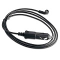
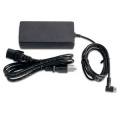
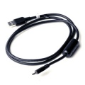
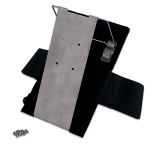
All units goes with Worldwide Basemap and Worldwide Terrain. What's in the box:
Accessories
Features
With the addition of IFR map mode, Garmin FliteCharts® and ChartView™, the GPSMAP 695 provides key functions of a Class 1/Class 2 electronic flight bag (EFB), reducing the use of paper charts in the cockpit. When in IFR map mode, the 695 can display victor airways, jet routes, minimum enroute altitudes and leg distance, much like what’s found on traditional enroute charts. With FliteCharts, you can quickly find and view all U.S. AeroNav Services, standard terminal arrival routes (STARs), approach charts and airport diagrams. Specifications
ApprovalDeclaration of Conformity Click here to download. FCC Compliance This device complies with part 15 of the FCC Rules. Operation is subject to the following two conditions:
This equipment has been tested and found to comply with the limits for a Class B digital device, pursuant to part 15 of the FCC rules. These limits are designed to provide reasonable protection against harmful interference in a residential installation. This equipment generates, uses, and can radiate radio frequency energy and may cause harmful interference to radio communications if not installed and used in accordance with the instructions. However, there is no guarantee that interference will not occur in a particular installation. If this equipment does cause harmful interference to radio or television reception, which can be determined by turning the equipment off and on, the user is encouraged to try to correct the interference by one of the following measures:
Installation
Operation
MaintenanceMaintenance of the GPSMAP 695 is ‘on condition’ only. This device can be repaired only at the Garmin factory or a Garmin authorized service center. This product does not contain any user-serviceable parts. Repairs should only be made by an authorized Garmin service center. Unauthorized repairs or modifications could result in permanent damage to the equipment, and void your warranty. |


